
Today is National Read a Road Map Day. It encourages people to go on an adventure the old fashioned way, with a paper map! We took the advice and drove up through Crawford Notch this afternoon.
A keyword search in the Conway Public Library's Henney History Room online catalog for the word "map" yields 475 results. Try it through this link here.
The collection includes tourist maps from guidebooks, geological maps, soil type maps and even a handwritten map by John Cannell on the back of photo on how to find the site of the Wizard Birch.
A search for the word "map" in our main library catalog here yields 21,118 items including maps, books on maps, and even novels with the word map in the title.
In this blog today, we will look at just a handful of maps intended to whet your appetite. Of course we would be happy to show you around our map collection and we do offer a free outreach program on historic maps and map making for local schools and community groups,
In this blog today, we will look at just a handful of maps intended to whet your appetite. Of course we would be happy to show you around our map collection and we do offer a free outreach program on historic maps and map making for local schools and community groups,
Let's start with the 1853 Bond map. We have two copies here of the book that it came from here. (click on images to enlarge them). The library has a number of copies of Benjamin Willey's book, Incidents in White Mountain History. For preservation reasons one of the maps was removed from the book and cataloged and stored separately listed in our catalog here.


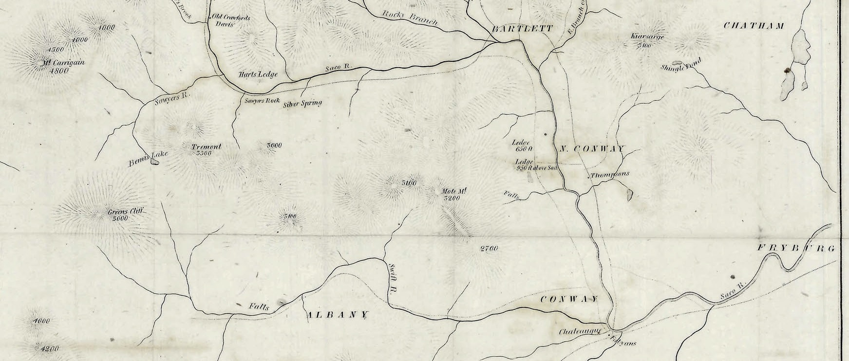

According to a description by Adam Apt on the White Mountain History website here, the map was issued in boards covered with cloths of different colors. In some copies, Benjamin Champney illustrations were printed on the reverse of the map; in others, these are printed on a separate sheet.
Now let's look at Boardman's White Mountain Guide, 1858. As you can see this map features the mountain topography more prominently. FMI see this link here.


Now let's look at the Eastman/Cavis map.

This copy is from the White Mountain History website here.
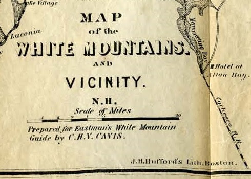

One of our copies at the Henney History Room shows the problem (inherent vice) of maps that have been "tipped" into books.


Now let's go way back in time. Did You Know that the Turin Papyrus is thought to be the oldest recorded road map in the world? Historians believe that it was created around 1160 BC.
.jpg)
FMI see this link here.
It is in fact also a treasure map. Inscriptions describe the "Mountain of the Gold”, the “Mountain of the Silver.” It is also the earliest known geological map because it showed the local distribution of different rock types, the diverse wadi gravels, and contained information on quarrying and mining.
Now for our final and most recent map. The map below was only created last month by cartographer Larry Garland and shows the planned trail into the Redstone Quarry as well as key landscape features and topography.
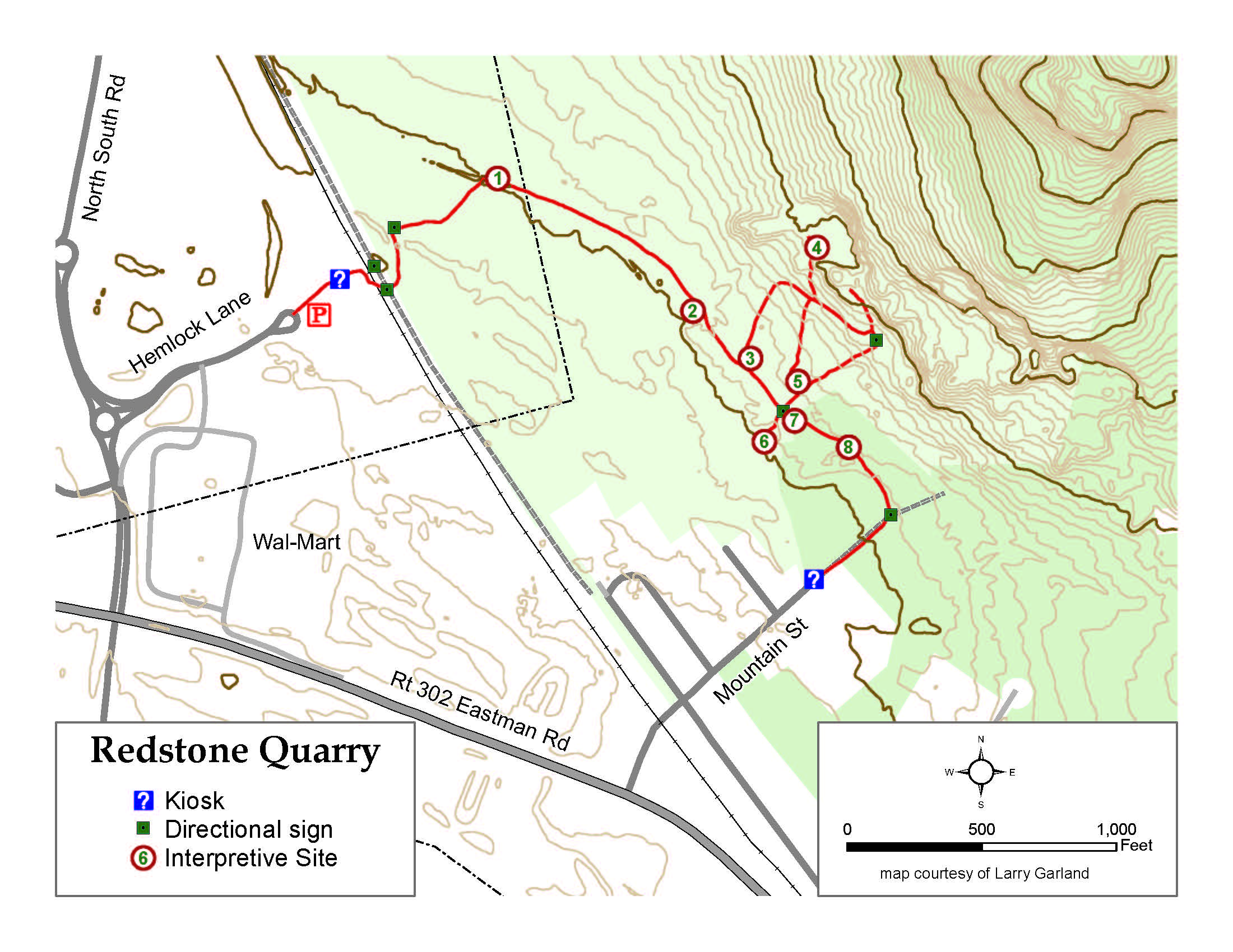
Larry collected the GPS data points with his high quality "backpack" style equipment on March 27, 2022.

For more information on this project or any local history topic contact us at the Conway Public Library.
No comments:
Post a Comment