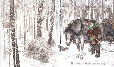
Recently a friend posted the illustration above by Susan Jeffers from a children's book on Robert Frost's poem along with the following on Facebook: “Three years ago this week, Frost’s poem “Stopping by the Woods on a Snowy Evening” became public domain. That poem is ours now. So, tonight, drop me your favorite line or stanza from Frost and what it means to your life.”
My reply focuses on the opening two lines:
The opening lines of this poem naturally make me think about traditional New England vernacular land use patterns and farming practices. Isn't it the same for you?
My reply focuses on the opening two lines:
Whose woods these are I think I know.
His house is in the village though;
The opening lines of this poem naturally make me think about traditional New England vernacular land use patterns and farming practices. Isn't it the same for you?
It raises the question, why would his house be separate from his woods? To address this enigma, we will turn to art, cartography, geology, ... and of course lasers.
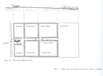
Historically, to make the best use of the land a typical early New England farmer would own a variety of lots in different areas of a town. The best place for a sugar bush may not be a good place to pasture cows, or plant an orchard, or build a home, so depending on topography, soil types, elevation and so on different lots in different parts of town would serve different purposes.
The land was organized by function - dooryard, barnyard, garden, crop fields, hay lots, pasture, and of course the woodlot. The paths connecting them were controlled by wood fences, gates, sheep dogs and stone walls. For our previous blog on reading stone walls from the ground and with lasers see this link here.

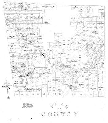
These lot patterns can be seen in an early map of Conway on display at the Conway Public Library.
A closer look at another version of that map shows that the Town founders adapted the size and shape of the lots to the land (click on images to enlarge them).
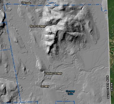
Here is a laser produced relief map known as LIDAR that shows the underlying topography of the town.
For example, the Cranmore Mountain area can be seen as a large blank spot. This was not assigned to any specific person but was instead considered common land. The lots in the flat fertile areas and along the low hills of town are large. The lots along the rivers are smaller, long and narrow to allow the greatest number of farmers to have their livestock have access to water.
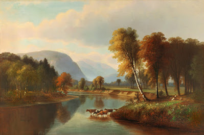
White Mountains artists captured scenes of livestock drinking from the Saco River in Conway, a practice that would not be allowed today. You can see a number of them here.
In his book, Big House, Little House, Back House, Barn, Thomas Hubka provides a great detailed explanation of these traditional field patterns.
In his 1792 History of New Hampshire, Jeremy Belknap provided a "how to" manual for pioneers. He explains the kinds of soils that can be found under different types of trees and how that particular soil should be prepared there and what kinds of crops grow best in those soils. It also details the kinds of products that can be made from different trees and plants.
Back to the children's book. I have always loved this edition of Robert Frost's poetry. You can check out this book with illustrations by Susan Jeffers at the Library as well as many other books she illustrated.
For more information on this or any other Mount Washington Valley topic contact us at the Conway Public Library's Henney History Room.
No comments:
Post a Comment