Monday, August 24, 2020

The Old Newman is New Again

Above: Conservator Martha Cox and the painting before cleaning and conservation treatment. 

Below: You can see the difference in the photo after treatment.

As part of a grant from the Robert and Dorothy Goldberg Foundation and support from the Friends of the Conway Public Library the painting has been cleaned and is back up on the wall. 

In a glass case on the opposite wall is a display about the artist, the painting and the treatment program.


An article from our online collection of the Reporter News for January 25, 1940 (page 7) documents the display of the painting and notes who the models were for the woman and the boy. 


Another article from our subject vertical file provides more detail. 


The article featured a photo by Roger S. Burnell.


For more information on the subject of the painting see our previous blog here


Tuesday, August 11, 2020

Hot Spots for ice Cream

With the forecast for another warm summer week, I thought we would follow up on ice cream.

This was once a favorite spot in North Conway for ice cream. It is now operated as an antique store. 

Here is a close up of the sign over the front door. According to the Conway Public Library's ancestry subscription, Ella May (Berry) Masson lived from 1855 - 1943. Her daughter Susie lived from 1877 - 1970.


Here is a business card of the place.

You can also find out more about Mrs. E. M. Masson and Daughter through the Conway Public Library's online collection of the Reporter News. Start your search at this link. The earliest reference I could find was here from 1895. They wintered in Florida and this January 7th, 1909 edition of the Reporter News described a "New Year's Token" of flowers they sent folks in Conway. The same page of the paper points out that people are preparing to fill their ice houses and that a church supper was to serve cold ham with potatoes a la cream (sounds interesting!). 

Of course, cream is a key ingredient in ice cream and that comes from a cow and was delivered in the old milk wagons. Local celebrity, Sut Marshall displays some of his collection each year at the Fryeburg Fair and has published a book on some of his wagons. 


Ice was cut from local ponds, stored in ice houses (such as the one that still exists pictured below) and delivered in horse drawn wagons.


The large ice house on the left from Payson Tucker's Birchmonte estate can still be seen at the Red Jacket Hotel in North Conway.


Here is an ice wagon from the library's collection.

In my search for "cool" things to enjoy in the summer, I ran across this paper weight advertisement that doubles as a relief map.

While it doesn't look too accurate to me, if you have one and are willing to donate it, it would make a nice addition to our collection. For more on relief maps see our previous blog here.

Many of you may remember the 28 flavors of ice cream served at the local Howard Johnson's.

If you have stories to share about Hojo's please write them in the comments section of this blog. For more on North Conway's Howard Johnson's see this link.

For more on Mount Washington Valley history contact us at the Conway Public Library's Henney History Room and keep cool!

Wednesday, July 29, 2020

Pond Water Ice Cream


With the recent heat waves, we have all been searching for a way to "chill out." I have been finding refreshment by examining old maps to savor a favorite taste of summer (mine is blueberry basil flavor). It is one of the ways I have been celebrating National Ice Cream Month. 

But what does this have to do with pond water as my blog title suggests? Well, take a look at the image above from the 1908 Sanborn insurance map from the collection of the Conway Public Library's Henney History Room (click on images to enlarge them). Can you find the three ice houses on the map that were once within a short distance from the library? (Hint: all are small wood frame buildings - indicated by the yellow color code - and located away from the street behind the main buildings. Two are associated with dwellings and one with a hotel).

The Conway Public Library is easy to find by its red color, representing brick. However, if you look closely at the library you will also find part of it with blue and the yellow. To find out why, see our previous blog here.

We will examine more on how these traditional ice houses worked and historic ways to make ice cream later, but where did the ice come from? To find the potential likely source of the ice for these ice houses let's go down the street and around a couple corners. Unfortunately, the 1908 map does not show this area, so let's jump ahead in time see it on our 1923 Sanborn insurance map.


The areas covered on the map are numbered and colored coded on the index page.The 1923 Sanborn map shows two ice houses on the shore of Pequawket Pond (note north is towards the left on this view of the map).


Early next month, the Upper Saco Valley Land Trust will present a couple related programs exploring Pequawket Pond. For more information see the links here and here


Here is a detail of the image above.


... and even closer detail.


Notice the grey shading around the outside of the ice house on the right.
According to the "Key" printed on the map, gray represents "iron" indicating that the building was sheathed in "iron" or tin.


In another version of the map, a "paste over" shows that the two ice houses were replaced or merged to become one larger one with conveyors suggesting that the operation was modernized.


Detail


Even closer detail.


Even though modernized, much of the industry continued to use simple, traditional tools. These techniques are presented each winter at numerous locations throughout New England, including at the Remick Farm Museum in Tamworth. The traditional ice harvesting process was also featured in the beginning of the first movie Frozen.


In the library's 1929 version of the Sanborn maps an ice cream mfg. (manufactory) shows up not far from the Conway Public Library in 1929.


Here you can see that building in the bottom left corner of this detail of the map and its relation to the "four corners" intersection of this detail of the map.  


Here is a "zoomed" out version.


For more information on your local history contact us at the Conway Public Library's Henney History Room.

Monday, July 13, 2020

Happy National Forest Week (July 13 - 19, 2020) from Devil's Den


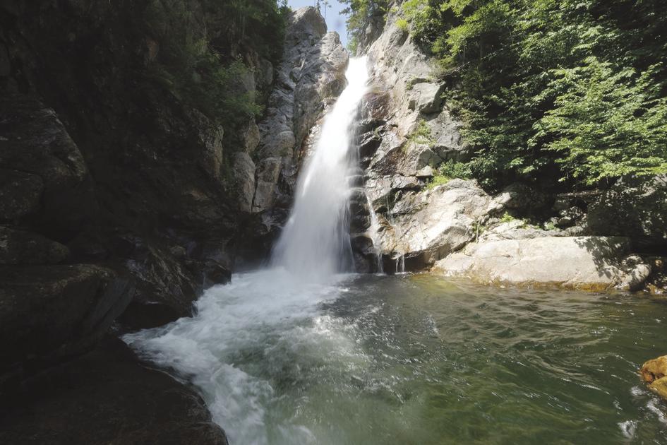
Happy National Forest Week (July 13 - 19, 2020). For how to celebrate see this link. For one thing, you can not celebrate it by hiking down to the base of this waterfall. A recent article in the Conway Daily Sun notes that it was closed today as part of the work being done by the White Mountain Trail Collective. However, you can virtually visit the waterfall through the Glen Ellis Falls Gallery on the website White Mountain Art and Artists. You can see the falls depicted under different light and liquid conditions.

By coincidence I also came across two articles today that provided some interesting insights into this holiday. The first was in a recent Smithsonian Magazine about the "invention of hiking" and the forest trails in Fountainbleau. See the link here. The second was in a recent New Hampshire Magazine about the famous Limmer Boots. You can read it here.

Some of the photos in the Smithsonian article reminded me of Diana's Baths and the Cathedral both visually and etymologically. For info on the "Cathedral" see my previous blog here.

Now we can move from heaven to hell. During the 19th century another popular tourist attraction was to be found at the base of Cathedral Ledge. Here is a stereoview from the interior of Devil's Den by Conway's own N. W. Pease from the collection of the Conway Historical Society.


Below are a series of photos and paintings from various collections that may help determine the mysterious location of the Devil's Den. The photo below is from the collection of the Museum of the White Mountains. You can read more about it at this link.


Below is a cropped version edited for brightness and contrast to better view the features and details.


A detail of the bottom of this photo shows from left to right, a horse drawn mountain wagon, a set of stairs, a shed of some sort, the opening to the Devil's Den, a man in a pith helmet, a camera on a tripod, a ladder, and another man in a pitch helmet (click on images to enlarge them).


The person sitting on top of the large rock above the opening to the Devil's Den shows the sense of scale.


In 1887, Winfield S. Nevins explains that a "Hermit Hapgood" would lead you into the Devil's Den with a pitch-pine or smoky birch-bark torch. You can read about it here. In his 1942 recollections, George Russell relates a similar story about the hermit. You can read about it here.

The bottom section of a painting at the New Hampshire Historical Society by Thomas Hill matches up quite well with the photo above.


Here is the entire painting.


You can learn more about it here.

Asher B. Durand did two paintings of Cathedral Ledge. One can be found at the Albany Institute here


While Durand's paintings are from slightly different angles than the images above many of the details are relatively easy to match up with Peg Immel's 1993 poster from our previous blog here.

Another Asher B. Durand, in a private collection, includes an artist sketching with a well dressed lady admiring the view. This image can be found on the White Mountain Art website here.


For more on the story contact us at the Conway Public Library's Henney History Room.

Sunday, June 28, 2020

Cathedral Ledge

This poster of Cathedral Ledge is on display in the Conway Public Library's Henney History Hall. It is the first object you will see at the bottom of the stairs on the left. 


Here is another view (click on images to enlarge them).


To learn more about the site see our entry on theclio website at this link. You can access this on your smart phone and it can lead you to the site. You can also check out a related video here (part of our Reel History series through Valley Vision.

Back to the poster. The artist's signature and date can be seen at the bottom right corner of the side view (P. Immel 1993).


Peggy now lives and works out west. You can read more about her and her work on her website here. She graciously gave us permission to post her work on this blog. You can purchase a copy of the print at as well as other books, maps and climbing gear at the International Mountain Equipment (IME) website or their store in North Conway.

The print also credits the publishers Lewis & Yardley.


According to Rick Wilcox at IME, these guys were early IME folks. Note that a portion of the proceeds goes to the Access Fund. You can read more about their work at their website here. You can read about some of their work on Cathedral Ledge at this link.

The panel to the right of Peggy's delicate and detailed line and wash view lists the rock climbing trails that are noted on the print (click on image to enlarge it).


Note the interesting names that describe these vertical trails. Below the main image is a view of the ledge as if seen from the top (aerial view) that is lined up to you can compare the two viewpoints and help map out the access to the trails. 


Cathedral Ledge is named for a feature that has an interesting history. It is noted on this print as #38. Here is a detail. 


While it was featured in many 19th century guidebooks and photographs, unlike some other features of this cliff that can be seen in the print such as the prow and the talus slope, there are no 19th century paintings of the Cathedral that I know of. For some White Mountain paintings showing the ledges see my previous blogs here, here and here and this White Mountain Art and Artists gallery here and here.

Here is a written description of the Cathedral and the Devil's Den from a tourist guidebook published in 1876. For a story with local interest on some of these guidebooks see our previous blog here.

Many of the photographic images of the Cathedral are from basically the same viewpoint including a stereo view published by Albert Bierstadt and his brothers from 1875.


There is a copy of this book at the New Hampshire Historical Society. It actually has the stereo viewer built into the cover of the book.


Here is a single image of the Cathedral from the Bierstadt book.


Here is my attempt to recreate the Bierstadt vantage point.


According to tradition, folks brought a foot powered pump organ and held church services up here.

The Cathedral is just an easy to moderate 5 minute walk on the yellow blazed trail from this sign. When you reach the wall of the ledge at the top of the sloping trail, the Cathedral will be just a few steps to your left.


The sign is on Cathedral Ledge Road 5/10 of a mile from the turn off on West Side Road. See a Google map here.

There are a number of trails linked together that you can explore if you are not a rock climber.


Enjoy!