... if only in your mind's eye.
Today is National Mountain Climbing Day. Not all of us can still climb mountains with the gusto of our children, but with the help of the Conway Public Library's Henney History Room you can enjoy the prospects just the same.
A good place to start is with a recent donation of thirty scrapbooks from a very experienced mountain climber who has hiked Everest, Kilimanjaro, and the highest peaks in the Andes. We are honored that he thought of us to preserve these priceless treasures.
Part of our job here is to help guide you to other collections that hold special items related to our local history. The drawing below from the collection of the New Hampshire Historical Society reveals that there were a number of ways people summited mountains over the years.
This drawing, depicting a group ascending Mount Kearsarge from Conway on September 8th, 1875, is one of many on a continuous panoramic scroll depicting a trip taken by a New York family to the White Mountains. Notice the ladies riding side saddle in long dresses and the man with the umbrella. Sun tans were not fashionable during the period.
The drawing is from one of my favorite items at the New Hampshire Historical Society in Concord - a "crankie" or panoramic device. You can learn more about it here.
The tourists apparently stayed at Mrs. S. D. Pendexter's boarding house in Intervale. See our previous blog here to find the Pendexter Mansion at the top of on an old map.
Winslow Homer depicted the bridle path to the top of Mount Washington in a famous painting at the Clark Art Museum here and his not so famous sketches at Cooper Hewitt here.
Homer did a particularly good job here capturing the character of the "felsenmeer" (German for "sea of rock") at the summit.
Riding a horse to the top of a mountain might seem very tame for today's rock climbers. A unique map in our collection artfully displays the vertical trails and natural features on Cathedral Ledge long with detailed technical descriptions.
The dominant feature near the center of the cliff is known as The Prow as it is shaped like the front of a boat. At its base is a triangular shaped accumulation of broken rocks known as a talus slope. Notice the colorful names of the climbing trails.
The Prow and talus slope can also be seen in a painting at the New Hampshire Historical Society by Thomas Hill.
For more information on the painting see this link.
Asher B. Durand did two paintings of Cathedral Ledge. One can be found at the Albany Institute here and in a private collection here. The large rocks at the base of the talus slope formed a feature promoted to tourists as the Devil's Den. We will explore this attraction in a future blog.
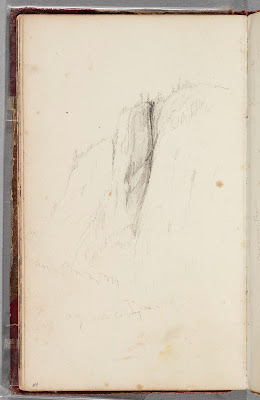
The earliest artistic portrayal of the Prow on Cathedral Ledge was done by Thomas Cole in one of this three visits here in 1827, 1828 or 1839. It is now at the Detroit Institute of the Arts and info on it can be found here.
A book in our collection combines research on art, maps and place names.
The NH Stone Wall Mapper website allows you to zoom in and view a variety of layers to study a specific spot. (click on images to enlarge them).
On this 1896 USGS map Kearsarge is labeled Pequawket Mtn, and Cranmore is called Lookout Point. By 1942, these mountains had the names we know today.
We have a number of relief maps available to study in the Conway Public Library's Henney History Room. The map below shows a good stretch of the White Mountains.
This one shows many of the 4,000 footers.
...with a detail showing the Mount Washington area.
As part of the 250th anniversary of Conway's grant students at the Pine Tree School created a relief map from corrugated cardboard featuring the relationship of Redstone village, its quarry and the nearby mountain.
Would you like your own pocket sized relief map to carry with you out into the field? If you line up the small 3d printed model in the foreground with the large version of Kensett's view of Mount Washington from Conway, you can actually match the peaks up pretty well. For more on this view see this blog here.
At the Conway Public Library we can help you make a relief map like this for about $2.00 on our 3d printer.
For more details on this or any other historical subject in the White Mountains, contact us at the Conway Public Library's Henney History Room.


No comments:
Post a Comment